HYPERBOLE ALERT: We found our favorite spot so far!! The thing is, we’re not exactly sure why. I mean, when you think about favorite island destinations, what’s on the checklist?
- Beautiful, white sand beaches! Nope. No beaches.
- Luxurious resorts catering to your every whim! Zero resorts. In fact, not even a hotel.
- Calm, secluded anchorages!. Definitely not. In fact, no anchorages at all.
- Hip, happening night life! Ahhh, no. Sorry.
- Exotic shopping options! No, no, not really.
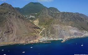
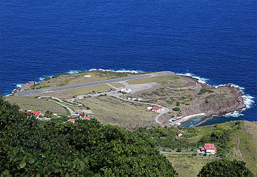
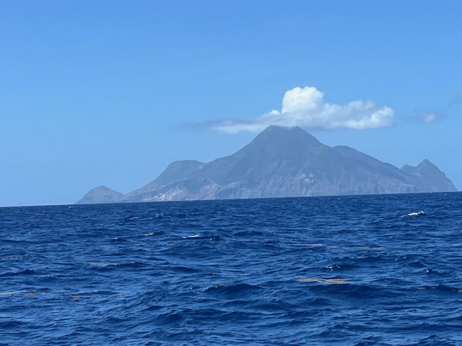
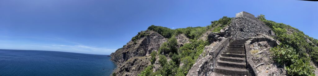
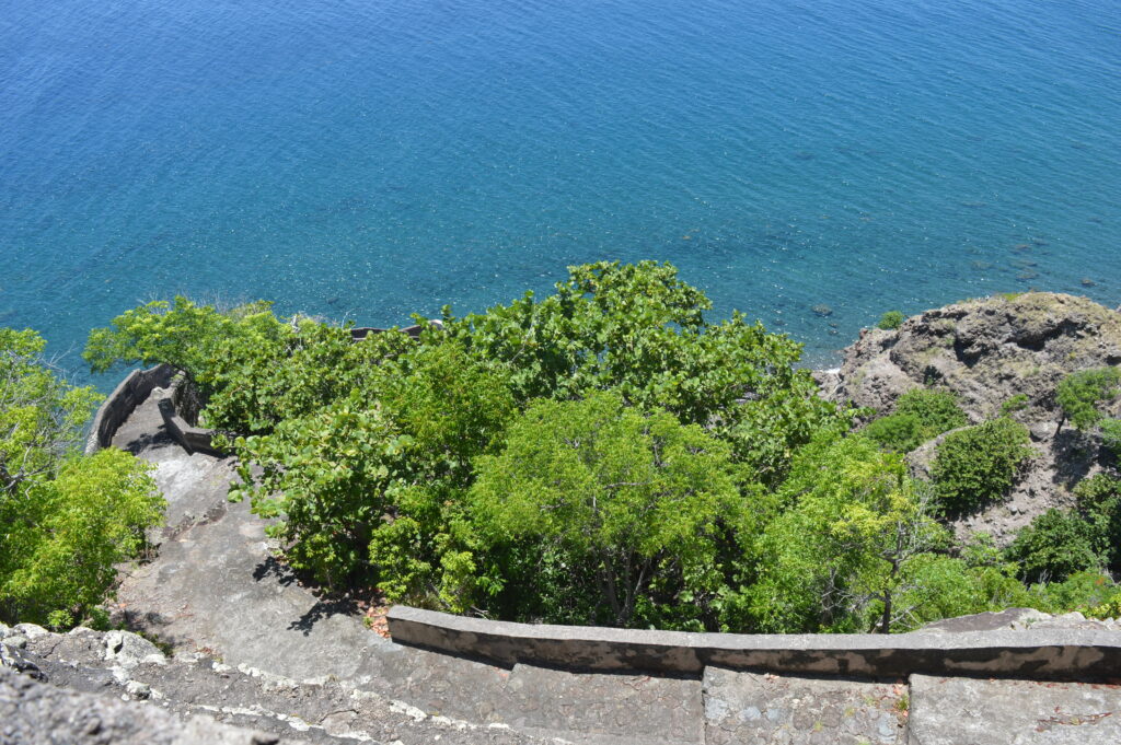
Let’s talk about Saba. I’m gonna go out on a limb and guess most of you have never heard of the place. Well, neither had we. Saba is a 5 square mile island about 25 miles south of St. Martin. It is a Dutch Overseas Municipality, meaning it is a city in the Netherlands, just like, for instance, Rotterdam. Except it’s in the Caribbean. It is, literally, the top of a volcano sprouting from the sea floor. We decided to visit because, well, I am attracted to weird, out-of-the-way places. It is very little-visited, hosting about 10,000 visitors a year. It only has about 125 available accommodations for guests. Why so few? Well, getting here is…challenging. Saba has the distinction of having the shortest commercial runway in the world. It is 400 meters (1,312 feet) long. On one side is a cliff. On the other three sides is ocean. It’s 60 feet above sea level. Takeoffs and landings can be, well, anxiety-provoking. One can also take a ferry, arriving at the only port, in fact the only dock, on the island-Fort Bay. Fort Bay wasn’t constructed until 1972, when it was literally blasted and scooped out of the lava. Prior to that, the only way to get cargo onto the island was via The Ladder. It’s like this: Cargo ships would anchor offshore. The cargo (food, building supplies, furniture, clothing, toilet paper, EVERYTHING) was brought to a small rocky beach in small boats. Then porters and mules would carry everything up “The Ladder”, which was 800 stone steps carved out of the side of the volcano, rising 500 feet to the closest village. Unless you see it, you can’t believe it. I (Bob) climbed it and can only marvel at the perseverance of the people who did this. Of course, when the Dutch settled Saba in the 1600s, it’s not like they were schlepping the stuff themselves-they brought enslaved Africans with them to handle that sort of thing. But after abolition, folks on the island continued to haul stuff up “The Ladder”. I posted a short video of my hike down and then back up The Ladder, if you’re interested.
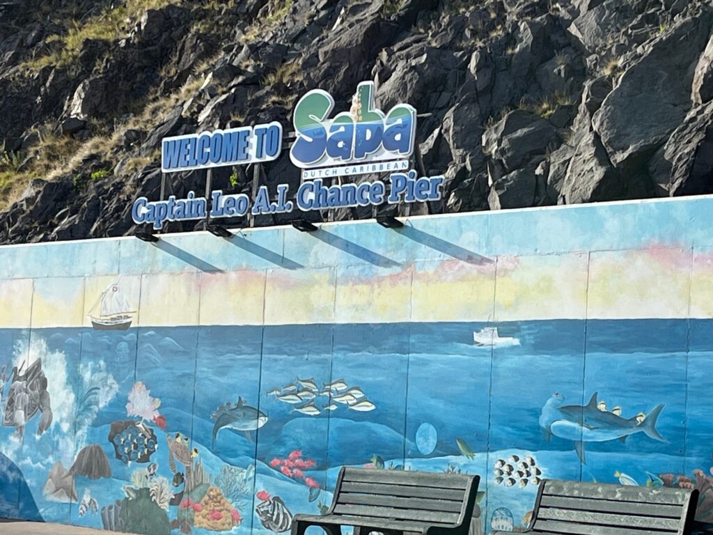
In any case, we have established that visiting Saba isn’t for the faint of heart. We learned this first-hand upon arrival. We picked up a mooring in front of Fort Bay so we could go ashore in the dinghy to check in. The seas were running 2-3 feet and the wind blowing 15 knots so Meraviglia was rocking and rolling all over the place! So much, in fact, that we couldn’t get the outboard on the dinghy without emperiling the dinghy, the outboard, and ourselves. We gave up. We motored back around to Ladder Bay (home of “The Ladder) and picked up a mooring there (there is no anchoring allowed on Saba). It was less rough there (not to say it was calm, because to call it a “bay” is to be beyond generous. It’s one side of the island. Then it was off in the dinghy to Fort Bay. Did I mention it was rough? Windy? Yes. Kim was terrified. I wouldn’t say we were in danger, but I’ve ridden tamer rollercoasters.

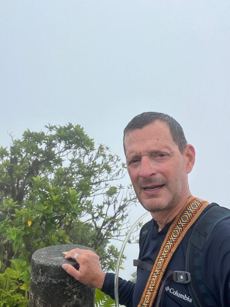
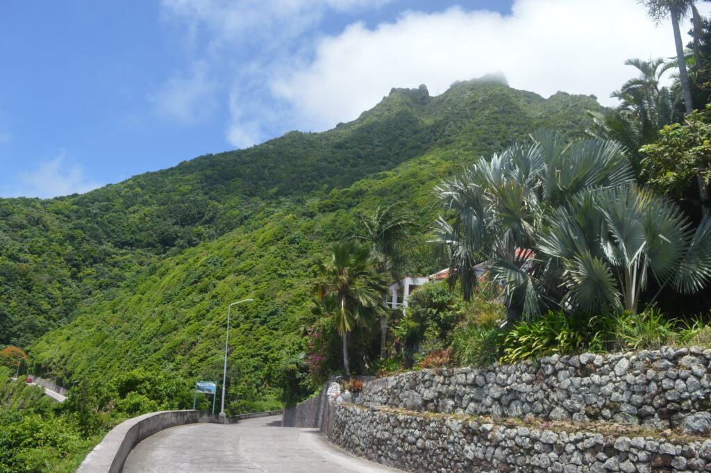
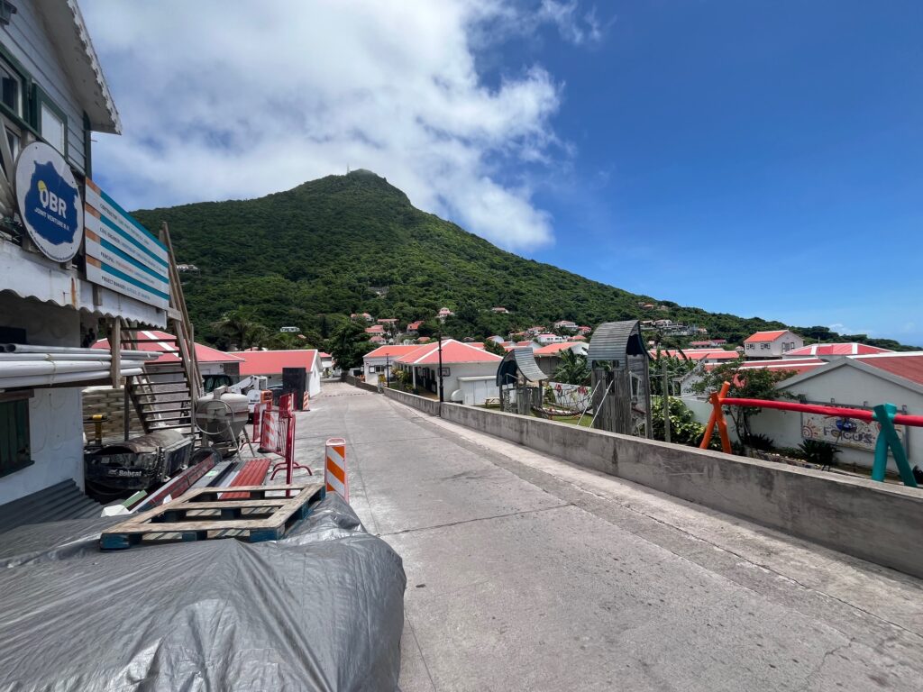
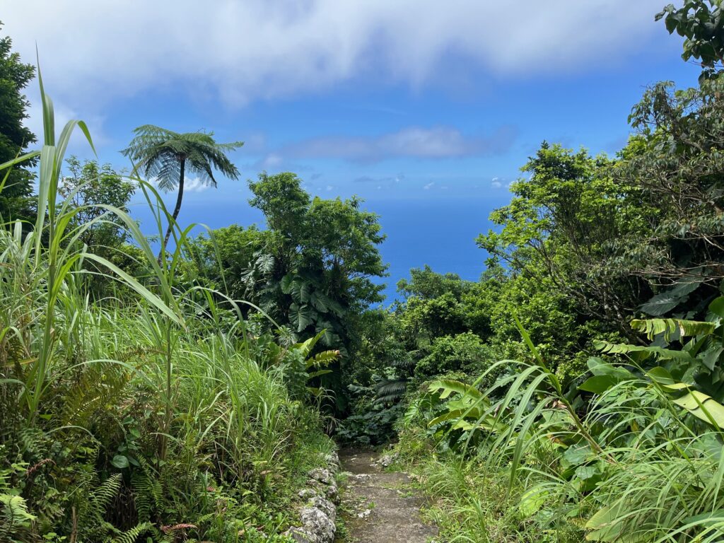
The next day we rented a car and went off adventuring. Now, the car itself is an adventure. There is exactly one road on the island. Did I mention the island is a volcano. There is no straight and level. It’s either up or down. Really up or really down. Because the road is impossible. As in it should not exist. It is actually called “The Road That Shouldn’t Exist”. Because in the early 20th century, Dutch engineers were asked to build a road across the island and declared that it could not be done. Enter a native Saba Islander. He TAUGHT HIMSELF ROAD ENGINEERING and starting in 1938, built a road across the island. It took 20 years and remember, the island is only 5 square miles. Driving it is not for the faint of heart. But off we went. First stop was Mount Scenery, which is the volcano itself. It is also the highest point in all of The Netherlands (I mean, most of the country is below sea level (think “Little Dutch Boy”), so it doesn’t take much, but still, at 2,910 feet, it’s not nothing. Up we went. Now, one might think that the top would afford one a sweeping, panoramic vista of the Caribbean. One might think that, but one might be mistaken. Because the top is a cloud forest. There is almost always a cloud over the peak. Know what clouds are? Water. So once we entered the top portion, it started to rain. At the top we could see…cloud. Still, HIGHEST POINT IN THE NETHERLANDS, BABY!! Back down we went.
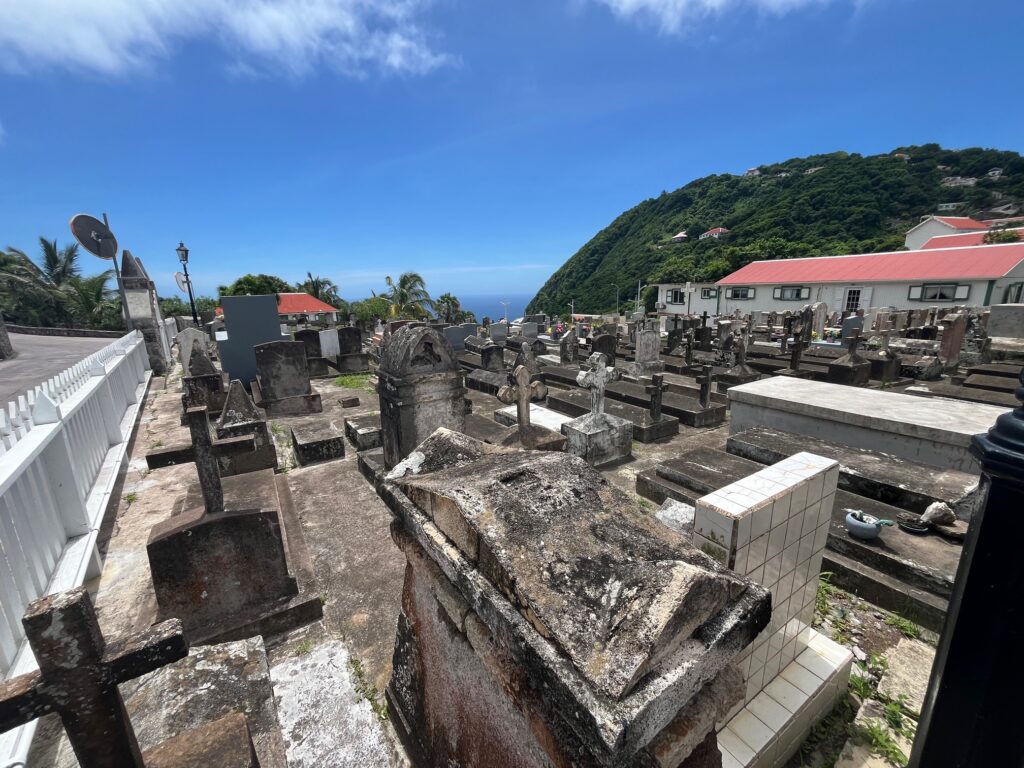
We also, as I said, visited “The Ladder” which was another brutal climb. In between, we visited the airport to check out the (tiny) runway and walked around the settlements of Windwardside and The Bottom. You’re just going to have to check out the pictures, because it’s magical. It’s beautiful. The island is lush, the settlements are neat and tidy. I can’t exactly explain why we were so enchanted, but we both were. It’s an amazing place. We could only marvel at the resourcefulness of the islanders. Living in such a place must be incredibly challenging.
We only stayed a day and a half because the mooring field was incredibly rough and, well, it’s a small spot-one can see it all in a day. But we’ll always remember it. Amazing.
June 13, 2024 at 1:38 pm
What a wonderful experience of discovery for you two! Never heard of it. Thanks for sharing
June 13, 2024 at 1:55 pm
Looks AMAZING! And, make a note—-when you’re next in New Orleans, there’s a terrific restaurant of the same name!
Continuing to enjoy reading about your adventures!
June 13, 2024 at 3:16 pm
Sounds like an amazing place. How do they generate their electricity?
June 14, 2024 at 11:08 am
Currently, it’s about 60% from diesel generators using fuel brought in by tanker and 40% renewables (solar and wind). However, they are currently investing in expanding renewables with a plan to be 100% renewable by 2025.
June 13, 2024 at 4:08 pm
Your description sounds a lot like Pitcairn Island. Very cool that you got to visit.