A question came up from one of our readers: How do you know when the weather is good for you to leave when the trip is a month? Great question!!
Context first: We’re in Panama on the Pacific coast, north of Panama City. Our destination is Hiva Oa in French Polynesia. That is 3,900 nautical miles from here (4900 land miles). For context, the shortest driving route from New York City to Los Angeles is 2,800 miles. Short version: it’s far. We estimate it will probably take us about 28 days. Could be as little as 23 or as many as 34. It depends on the weather! And how do we determine that the weather is okay for us to go? That is a combination of forecasting, knowledge of history, and educated guesswork. Obviously, there are no forecasts that go out further than 7-10 days. And beyond 5 days, such forecasts are often not very accurate. So. What to do?
Let’s start with big picture: We are out of hurricane season in the eastern Pacific, so we don’t need to worry about that. And the western Pacific hurricane zone doesn’t extend to French Polynesia, so we’re clear on the destination end as well in terms of tropical weather. We also know we are going to be sailing close to something called the Intertropical Convergence Zone. Commonly known as “The Doldrums”, the ICTZ is a band of very light winds that circles the equator. It’s where trade winds from the Northern and Southern Hemispheres meet. Not only do the winds tend to cancel each other out, but there can often be a lot of squalls and thunderstorms. Minimizing time in The Doldrums is part of our route planning.
So here’s what we do:
First, we rely on historical data to determine that we’re not likely, at this time of year, to run into any significant storms. Second, we look for favorable conditions near our departure point and then forecast out for about 5 days. This way, we can be confident that we are going to get a good start over the first few days. That should carry us out to the Tradewinds, which are generally reliable and will hopefully whisk us across the Pacific to French Polynesia. We also look at current maps and try to stay in zones with favorable current. There tends to be a pretty strong current running from east to west that should help carry us along at 2-3 knots.
Let’s take a look at this step-by-step:
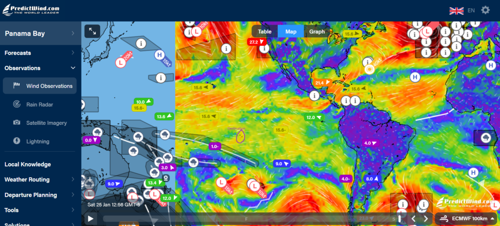
This is the big picture showing wind. Red is higher wind speeds. Blue is calm areas. You can see our destination circled. Generally, you see areas of green and orange pretty consistently between Panama and French Polynesia. Those are the Tradewinds.
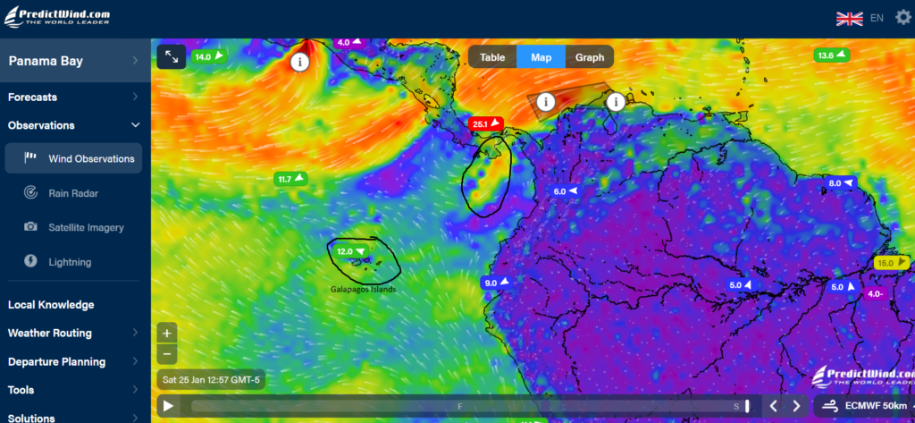
Here’s a zoomed in image of the area we’ll be sailing in for about the first week. See the “jet” of red/orange circled off the coast of Panama? That’s what we want: nice strong winds to send us on our way. We’ll head southwest and loop under the Galapagos Islands and then head west.
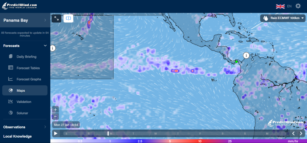
This one shows rain. See that band of rain in an east-west band across the ocean? That’s the ICTZ (The Doldrums). We’ll stay south of that. But there’s also rain/squall chances in the Bay of Panama closer to shore that we’ll likely not be able to avoid completely.
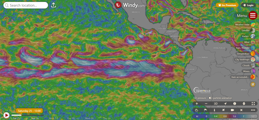
This is a map of currents. We want to hopefully stay in the silver/blue areas as much as possible to pick up the 2-3 knot current headed west.
So that’s how we “do weather” in a nutshell. We look at it every day. Right now, it looks like we have a window this coming week. We may be able to leave Tuesday or Wednesday. We are provisioned up except for eggs and produce, which we’ll get at the last minute. I need to clean the hull and take care of a few last minute things, but overall, I think we’re ready!
Want to track us in real time? Check out our PredictWind Tracker!

Thanks for the weather lesson! May you have safe passage to French Polynesia! I’ll be tracking your route!
Cool! Safe travels!!
Fare the Well dear friends and safe passage to FP